


November
2015
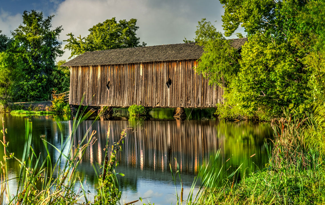
ALAMUCHEE-BELLAMY COVERED BRIDGE
Where: Livingston in Sumter County, Alabama
When Built: 1861
GPS Coordinates: 32°31′19.75″N, 88°11′12.22″W
During the Civil War, Confederate forces, led by General Nathan Bedford Forrest, used the Alamuchee-Bellamy Bridge as a path to Mississippi. This 88-foot-long structure was restored and moved to the University of West Alabama campus (behind Reed Hall) in 1969.
See all 14 of the covered bridges we photographed in Alabama at this link.


All photography by Gary Clark, a former Southern Living Magazine travel photographer and photographer of the United States Postal Service 2014 Star-Spangled Banner Forever stamp. See more of Gary's work and contact him at www.thegaryclark.com.


Your email address will not be published. Required fields are marked*